![](/images/other/stat-length.png)
![Tour Zu Fuß Tavernole sul Mella - Caregno - Rifugio C.A.I. Valtrompia (Innesto Sentiero 325) - Photo](https://media.geolcdn.com/t/1900/400/d4c86f68-447e-4734-a381-b72340585315.jpeg&format=pjpeg&maxdim=2)
Caregno - Rifugio C.A.I. Valtrompia (Innesto Sentiero 325)
SityTrail - itinéraires balisés pédestres
Tous les sentiers balisés d’Europe GUIDE+
![Länge](/images/other/stat-length.png)
Länge
5,5 km
![Maximale Höhe](https://static1.geolcdn.com/siteimages/upload/files/1508320355ic_sort_altitude_max_24dp.png)
Maximale Höhe
1353 m
![Positive Höhendifferenz](https://static1.geolcdn.com/siteimages/upload/files/1508320355ic_sort_den_pos_24dp.png)
Positive Höhendifferenz
75 m
![Km-Effort](/images/other/stat-length.png)
Km-Effort
7,5 km
![Min. Höhe](https://static1.geolcdn.com/siteimages/upload/files/1508320355ic_sort_altitude_min_24dp.png)
Min. Höhe
1006 m
![Negative Höhendifferenz](https://static1.geolcdn.com/siteimages/upload/files/1508320355ic_sort_den_neg_24dp.png)
Negative Höhendifferenz
381 m
![Boucle](https://static1.geolcdn.com/siteimages/upload/files/16400158638029165_repeat_loop_refresh_sync_direction_icon.png)
Boucle
Nein
Kennzeichnung
Erstellungsdatum :
2022-02-15 02:19:34.057
Letzte Änderung :
2022-02-28 22:32:11.014
![Zu Fuß](https://static1.geolcdn.com/sitytour/trail-icons/100.png)
1h42
Schwierigkeit : Einfach
![Scannen Sie diesen QR-Code, um die Tour in der SityTrail-Anwendung zu öffnen](https://capi.geolives.com/qq0zvz2zws4bq2lad0pu/sitytour/trails/3113837/qr.png?size=200)
Kostenlosegpshiking-Anwendung
Über SityTrail
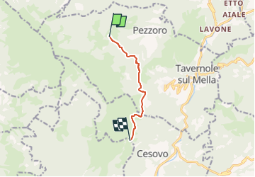
Tour Zu Fuß von 5,5 km verfügbar auf Lombardei, Brescia, Tavernole sul Mella. Diese Tour wird von SityTrail - itinéraires balisés pédestres vorgeschlagen.
Beschreibung
Trail created by Club Alpino Italiano - Sezione di Gardone Val Trompia.
Symbol: 320 on white red flag
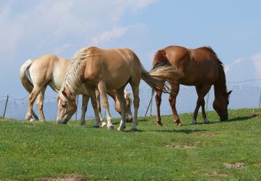
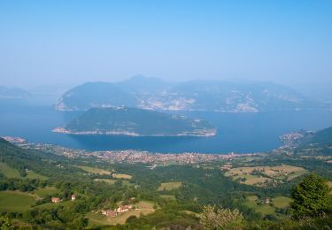
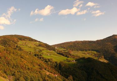
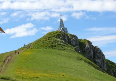
Ort
Land:
Italy
Region :
Lombardei
Abteilung/Provinz :
Brescia
Kommune :
Tavernole sul Mella
Standort:
Unknown
Gehen Sie:(Dec)
Gehen Sie:(UTM)
593161 ; 5068044 (32T) N.
Kommentare
Touren in der Umgebung
![Tour Zu Fuß Pisogne - Malghe in Rete - Trekking - Le Valli Tappa 1 - Photo](https://media.geolcdn.com/t/375/260/cd3c3cb5-4f30-4630-ac8b-b0439d0dd219.jpeg&format=jpg&maxdim=2)
![Zu Fuß Zu Fuß](https://static1.geolcdn.com/sitytour/trail-icons/100.png)
Malghe in Rete - Trekking - Le Valli Tappa 1
Zu Fuß
Medium
Pisogne,
Lombardei,
Brescia,
Italy
![](/images/other/stat-length.png)
12,7 km | 20 km-effort
4h 35min
![](https://static1.geolcdn.com/siteimages/upload/files/16400158638029165_repeat_loop_refresh_sync_direction_icon.png)
Nein
![Tour Zu Fuß Zone - Malghe in Rete - Trekking - Le Creste Tappa 2 - Photo](https://media.geolcdn.com/t/375/260/c6a57bf8-27f9-437c-a742-0b6ebff9c5c0.jpeg&format=jpg&maxdim=2)
![Zu Fuß Zu Fuß](https://static1.geolcdn.com/sitytour/trail-icons/100.png)
Malghe in Rete - Trekking - Le Creste Tappa 2
Zu Fuß
Einfach
Zone,
Lombardei,
Brescia,
Italy
![](/images/other/stat-length.png)
5,5 km | 7,8 km-effort
1h 46min
![](https://static1.geolcdn.com/siteimages/upload/files/16400158638029165_repeat_loop_refresh_sync_direction_icon.png)
Nein
![Tour Zu Fuß Pisogne - Malghe in Rete - Trekking - Photo](https://media.geolcdn.com/t/375/260/cd3c3cb5-4f30-4630-ac8b-b0439d0dd219.jpeg&format=jpg&maxdim=2)
![Zu Fuß Zu Fuß](https://static1.geolcdn.com/sitytour/trail-icons/100.png)
Malghe in Rete - Trekking
Zu Fuß
Medium
Pisogne,
Lombardei,
Brescia,
Italy
![](/images/other/stat-length.png)
12,7 km | 20 km-effort
4h 35min
![](https://static1.geolcdn.com/siteimages/upload/files/16400158638029165_repeat_loop_refresh_sync_direction_icon.png)
Nein
![Tour Zu Fuß Pisogne - Malghe in Rete - Anello 5 - Val Palot - Photo](https://media.geolcdn.com/t/375/260/cd3c3cb5-4f30-4630-ac8b-b0439d0dd219.jpeg&format=jpg&maxdim=2)
![Zu Fuß Zu Fuß](https://static1.geolcdn.com/sitytour/trail-icons/100.png)
Malghe in Rete - Anello 5 - Val Palot
Zu Fuß
Medium
Pisogne,
Lombardei,
Brescia,
Italy
![](/images/other/stat-length.png)
15 km | 25 km-effort
5h 36min
![](https://static1.geolcdn.com/siteimages/upload/files/16400158638029165_repeat_loop_refresh_sync_direction_icon.png)
Ja
![Tour Zu Fuß Zone - Malghe in Rete - Anello 4 - Punta Caravina - Photo](https://media.geolcdn.com/t/375/260/3b68b97d-5728-4ef9-b237-22c5f47408b8.jpeg&format=jpg&maxdim=2)
![Zu Fuß Zu Fuß](https://static1.geolcdn.com/sitytour/trail-icons/100.png)
Malghe in Rete - Anello 4 - Punta Caravina
Zu Fuß
Medium
Zone,
Lombardei,
Brescia,
Italy
![](/images/other/stat-length.png)
13,5 km | 25 km-effort
5h 36min
![](https://static1.geolcdn.com/siteimages/upload/files/16400158638029165_repeat_loop_refresh_sync_direction_icon.png)
Ja
![Tour Zu Fuß Zone - Malghe in Rete - Anello 2 - Monte Guglielmo - Photo](https://media.geolcdn.com/t/375/260/3b68b97d-5728-4ef9-b237-22c5f47408b8.jpeg&format=jpg&maxdim=2)
![Zu Fuß Zu Fuß](https://static1.geolcdn.com/sitytour/trail-icons/100.png)
Malghe in Rete - Anello 2 - Monte Guglielmo
Zu Fuß
Einfach
Zone,
Lombardei,
Brescia,
Italy
![](/images/other/stat-length.png)
5,1 km | 7,2 km-effort
1h 38min
![](https://static1.geolcdn.com/siteimages/upload/files/16400158638029165_repeat_loop_refresh_sync_direction_icon.png)
Nein
![Tour Zu Fuß Sale Marasino - Malghe in Rete - Anello 1 - Punta Almana - Photo](https://media.geolcdn.com/t/375/260/137222f4-a6e5-471c-b19c-95331109b02c.jpeg&format=jpg&maxdim=2)
![Zu Fuß Zu Fuß](https://static1.geolcdn.com/sitytour/trail-icons/100.png)
Malghe in Rete - Anello 1 - Punta Almana
Zu Fuß
Medium
Sale Marasino,
Lombardei,
Brescia,
Italy
![](/images/other/stat-length.png)
12,1 km | 25 km-effort
5h 41min
![](https://static1.geolcdn.com/siteimages/upload/files/16400158638029165_repeat_loop_refresh_sync_direction_icon.png)
Ja
![Tour Zu Fuß Pisogne - Passabocche - Aguina - Photo](https://media.geolcdn.com/t/375/260/4faf0ed2-71a5-4f70-a20b-622ea499c1c9.jpeg&format=jpg&maxdim=2)
![Zu Fuß Zu Fuß](https://static1.geolcdn.com/sitytour/trail-icons/100.png)
Passabocche - Aguina
Zu Fuß
Einfach
Pisogne,
Lombardei,
Brescia,
Italy
![](/images/other/stat-length.png)
4,4 km | 6,2 km-effort
1h 25min
![](https://static1.geolcdn.com/siteimages/upload/files/16400158638029165_repeat_loop_refresh_sync_direction_icon.png)
Nein
![Tour Zu Fuß Tavernole sul Mella - Tavernole sul Mella (Pezzoro) - Monte Guglielmo - Photo](https://media.geolcdn.com/t/375/260/0246c0e4-bbee-4778-837d-9d070918e3fc.jpeg&format=jpg&maxdim=2)
![Zu Fuß Zu Fuß](https://static1.geolcdn.com/sitytour/trail-icons/100.png)
Tavernole sul Mella (Pezzoro) - Monte Guglielmo
Zu Fuß
Einfach
Tavernole sul Mella,
Lombardei,
Brescia,
Italy
![](/images/other/stat-length.png)
5,6 km | 15,8 km-effort
3h 34min
![](https://static1.geolcdn.com/siteimages/upload/files/16400158638029165_repeat_loop_refresh_sync_direction_icon.png)
Nein